
Introduction
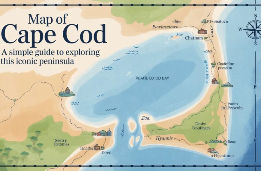
Have you ever looked at a map of Cape Cod and thought, Wow, this place really does look like an arm? You’re not alone. Cape Cod’s famous hook shape isn’t just charming—it tells a story about beaches, towns, history, and travel routes. Whether you’re planning a summer vacation, a weekend getaway, or you’re just curious, understanding the map of Cape Cod makes everything easier.
Think of the map as a treasure map. Each town is a hidden gem, each road a clue, and each beach a reward waiting at the end. Let’s unfold this map together and see what makes Cape Cod so special.
Where Is Cape Cod Located?
Cape Cod is located in eastern Massachusetts, stretching into the Atlantic Ocean. On a map of the United States, it sits to the right side of the state, just below Boston. The canal separates it from the mainland, making it feel like an island—even though it technically isn’t.
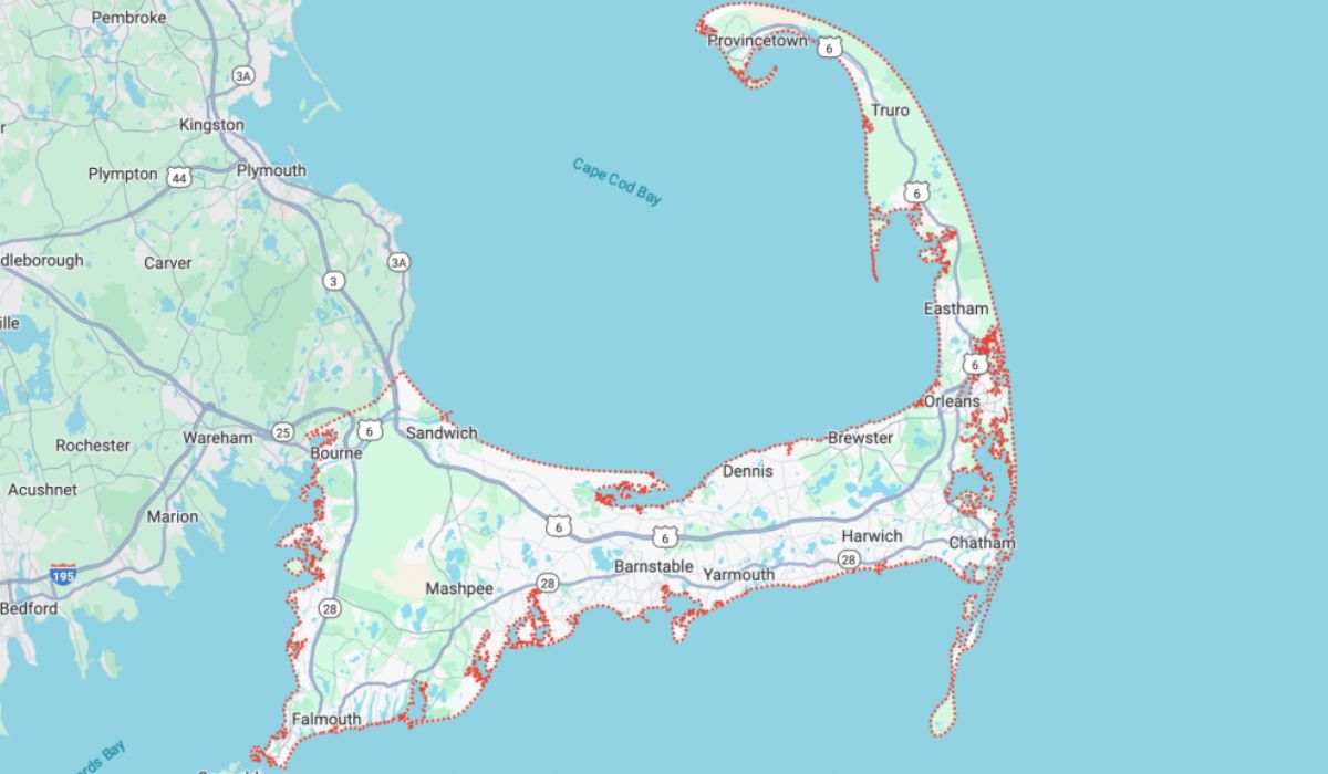
When you look at a map of Cape Cod, you’ll notice water everywhere. The Atlantic Ocean hugs one side, while Cape Cod Bay cradles the other. This geography explains why beaches are never far away.
The Famous Shape of Cape Cod Explained
Cape Cod’s shape looks like a bent arm with a clenched fist. Locals even have names for parts of it, like the “elbow” and the “forearm.” This shape was formed thousands of years ago by glaciers pushing sand and rock into place.
On the map of Cape Cod, this curve matters. It affects weather, driving distances, and beach types. Calm bay beaches sit on one side, while wild ocean waves crash on the other.
Understanding Cape Cod Regions on the Map
Cape Cod is divided into four main regions, clearly marked on most maps:
-
Upper Cape
-
Mid Cape
-
Lower Cape
-
Outer Cape
These regions help visitors understand distances and plan trips. Think of them like chapters in a book—each one has a different mood and story.
Upper Cape: The Gateway to the Cape
The Upper Cape is where you first arrive after crossing the bridges. On a map of Cape Cod, it sits closest to the mainland.
Key towns include:
-
Bourne
-
Sandwich
-
Falmouth
-
Mashpee
This area is quieter and more residential. It’s perfect if you want easy access and fewer crowds, kind of like the front porch of the Cape.
Mid Cape: The Commercial Heart
The Mid Cape is right in the center and often the busiest part. On the map, it’s easy to spot because major roads pass through here.
Popular towns include:
-
Barnstable
-
Hyannis
-
Yarmouth
-
Dennis
Hyannis stands out on the map of Cape Cod as a transportation hub, with ferries, buses, and shopping areas. If the Cape were a wheel, Mid Cape would be the hub.
Lower Cape: History and Harbors
Moving further along the arm, the Lower Cape feels more historic and relaxed.
Towns you’ll see on the map include:
-
Brewster
-
Chatham
-
Harwich
-
Orleans
Chatham, especially, is easy to spot due to its location near the “elbow.” This area is known for charming harbors, lighthouses, and classic New England vibes.
Outer Cape: Beaches and National Seashore
The Outer Cape is the most dramatic part of the map of Cape Cod. It curves upward and ends at Provincetown.
Key towns include:
-
Eastham
-
Wellfleet
-
Truro
-
Provincetown
Much of this area is protected as the Cape Cod National Seashore, which you’ll see clearly marked on maps. Wide beaches, dunes, and walking trails dominate this region.
Major Towns on the Map of Cape Cod
A good map of Cape Cod highlights towns clearly. Each town has its own personality.
-
Provincetown: At the very tip, artsy and lively
-
Hyannis: Central, busy, and well-connected
-
Falmouth: Near ferries to Martha’s Vineyard
-
Chatham: Scenic and upscale
Knowing where these towns sit helps you choose where to stay and what to explore.
Beaches and Coastal Landmarks
One of the best uses of a map of Cape Cod is finding beaches. Maps often mark public beaches, lighthouses, and parks.
-
Ocean-side beaches: Big waves, great for surfing
-
Bay-side beaches: Calm water, perfect for families
-
Sound-side beaches: Warm water and sunsets
It’s like choosing between different flavors of ice cream—each side offers something special.
Roads, Highways, and Bridges
Cape Cod may look small, but driving can take time. On the map, Route 6 is the main highway running through the Cape.
Important bridges include:
-
Bourne Bridge
-
Sagamon Bridge
These bridges are often marked clearly because traffic can back up, especially in summer. A quick glance at the map of Cape Cod can save you hours.
Public Transportation on Cape Cod
Maps don’t just show roads—they also show bus routes, ferry lines, and bike paths.
-
Buses: Connect most towns
-
Ferries: Go to islands like Nantucket
-
Bike trails: Especially along old rail lines
If you don’t want to drive, the map of Cape Cod helps you move around smartly.
Using a Map of Cape Cod for Trip Planning
Planning without a map is like cooking without a recipe—it might work, but it’s risky. A detailed map helps you:
-
Choose where to stay
-
Estimate travel times
-
Find attractions nearby
By studying the map of Cape Cod ahead of time, you can relax once you arrive.
Digital vs. Paper Maps
Should you use your phone or a paper map? Both have value.
Digital maps:
-
Real-time traffic
-
Easy search
Paper maps:
-
No battery needed
-
Big-picture view
Many travelers use both. A paper map of Cape Cod is great for understanding layout, while digital maps help on the road.
Seasonal Changes and Map Use
Cape Cod changes with the seasons, and so does how you use the map.
-
Summer: Focus on beaches and traffic routes
-
Fall: Scenic drives and quiet towns
-
Winter: Limited services, but peaceful
Maps sometimes show seasonal notes, which can be a real lifesaver.
Why the Map of Cape Cod Matters
A map of Cape Cod isn’t just lines and names. It’s a storytelling tool. It shows how land meets sea, how towns connect, and how history shaped the region.
Once you understand the map, the Cape feels less confusing and more welcoming—like visiting a friend instead of a stranger.
Conclusion
The map of Cape Cod is your key to unlocking everything this beautiful peninsula offers. From busy towns to quiet beaches, from winding roads to open ocean, the map ties it all together. Whether digital or paper, simple or detailed, it helps you travel smarter and enjoy more. So next time you head to the Cape, take a moment to really look at the map—you might be surprised by what you discover.
Frequently Asked Questions (FAQs)
1. Why does Cape Cod look like an arm on the map?
Cape Cod’s shape was formed by glaciers thousands of years ago, creating its famous curved “arm” appearance.
2. What is the best map of Cape Cod for tourists?
A tourist-friendly map of Cape Cod includes towns, beaches, major roads, and attractions, making navigation easier.
3. How many towns are shown on a map of Cape Cod?
maps show 15 towns, each with its own boundaries and landmarks.
4. Can I explore Cape Cod using only a digital map?
Yes, but having a paper map of Cape Cod can help you understand the overall layout better.
5. Does the map of Cape Cod change seasonally?
The land doesn’t change, but seasonal maps may highlight traffic patterns, ferry routes, and open attractions.
for more visit; urbannestle


 By
By